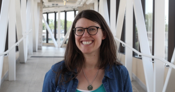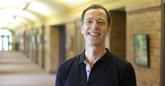
Natalia Wiederkehr she/her
Post-doctoral Researcher

Natalia is a Post-doctoral Researcher in Biodiversity Monitoring and Climate Change Adaptation in LINCZ (Locally-led Indigenous Nature-based Solutions to Climate Change Adaptation in Zimbabwe) Project. She supports the project through the application of spatial analysis to monitor landscape-scale outcomes of nature-based solutions for restoring forest, wetland, and degraded agricultural lands, and for protecting and enhancing biodiversity in the areas of interest.
Prior to joining CMU, she worked as a Remote Sensing and Geoprocessing Researcher at Brazilian Agricultural Research Corporation (Embrapa) with focus on monitoring deforestation and forest degradation in the Amazon Forest. Also worked at Cargill being responsible for palm oil mapping in Latin America and with sustainability projects, such as the development and management of web applications of traceability, from agricultural crop production chain in compliance of the environmental laws in force at national level and international certifications.
On general, Natalia has with research focus is monitoring land use and land cover and environmental changes, including forest response to multiple environmental stressors, and carbon accounting, combining different datasets, with the aim of identifying the main actors responsible for transformations and modifications in/of landscapes, in order to understand the temporal and spatial dynamics occurring in geographic space to support conservation efforts and policies.
Natalia holds a BSc in Geography from Federal Universty of Santa Catarina (Brazil), a MSc and PhD in Remote Sensing from National Institute for Space Research (Brazil).
Education
PhD (Remote Sensing), National Institute for Space Research (INPE), 2022; MSc (Remote Sensing), INPE, 2018; BSc (Geography), Federal University of Santa Catarina, 2013
Work in Detail
Research
Wiederkehr NC., Gama FF., Bispo P.d.C. Assessing ALOS-2/PALSAR-2 Data's Potential in Detecting Forest Volume Losses from Selective Logging in a Section of Tapajós National Forest. Environ. Sci. Proc. 2024, 29, 27. https://doi.org/10.3390/ECRS2023-15984
da Conceição Bispo P., Picoli MCA., Marimon BS. et al. Overlooking vegetation loss outside forests imperils the Brazilian Cerrado and other non-forest biomes. Nat Ecol Evol 8, 12–13 (2024). https://doi.org/10.1038/s41559-023-02256-w.
Gama FF., Wiederkehr NC., da Conceição Bispo, P. Removal of Ionospheric Effects from Sigma Naught Images of the ALOS/PALSAR-2 Satellite. Remote Sens. 2022, 14, 962. https://doi.org/10.3390/rs14040962.
Silva Junior CHL., Moura YM., Pessôa ACM., Trevisan DP., Mendes FS., Reis JBC., Picoli MCA., Wiederkehr NC., Carvalho NS., Dalagnol R., Kuck TN., Rosan TM., Silva TSF., Liesenberg V., Bispo PC. Surviving as a young scientist in Brazil. Science. 2021 Nov 19;374(6570):948. doi: 10.1126/science.abm8160. Epub 2021 Nov 18. PMID: 34793204.
Wiederkehr, NC.; Gama, FF.; Castro, PBN.; Bispo, PdC.; Balzter H.; Sano, EE.; Liesenberg V.; Santos, JR.; Mura, JC. Discriminating Forest Successional Stages, Forest Degradation, and Land Use in Central Amazon Using ALOS/PALSAR-2 Full-Polarimetric Data. Remote Sens. 2020, 12, 3512. https://doi.org/10.3390/rs12213512.
Oldoni LV., Prudente VHR., Diniz JMFS., Wiederkehr NC., Sanches ID., Gama FF. Polarimetric SAR data from Sentinel-1A applied to early crop classification. In: Int. Arch. Photogramm. Remote Sens. Spatial Inf. Sci, 2020, Nice. Int. Arch. Photogramm. Remote Sens. Spatial Inf. Sci, 2020. v. XLIII. p. 1039-1046.
Oliveira MT., Seixas HT., Justi IF., Oldoni LV., Wiederkehr NC., Moraes EC., Shimabukuro YE., Galvao LS., Sanches IA. Relação entre Índice de Área Foliar e Índices de Vegetação em Lactuca Sativa L. In: XIX Simpósio Brasileiro de Sensoriamento Remoto, 2019, Santos. XIX Simpósio Brasileiro de Sensoriamento Remoto, 2019. p. 1-4.
Wiederkehr NC., Ribeiro RM., Franca DGM., Moreira MA., Gama FF. Mapeamento do uso e cobertura da terra na Comunidade de São Jorge - Belterra PA.. In: XVIII Simpósio Brasileiro de Sensoriamento Remoto, 2017, Santos. XVIII Simpósio Brasileiro de Sensoriamento Remoto,, 2017. p. 1-8.
Silva AL., Almeida CT., Wiederkehr NC.,Ribeiro RM., Korting TS., Gama FF. Application of the Linear Spectral Mixture Model in vegetation change detection based on the Green Vegetation Index. In: XVIII Simpósio Brasileiro de Sensoriamento Remoto, 2017, Santos. XVIII Simpósio Brasileiro de Sensoriamento Remoto, 2017. p. 1-8.
Wiederkehr NC., Gama FF., Santos JR., Mura JC., conceicao PB., Liesenberg V. Análise de imagens polarimétricas do sensor ALOS/PALSAR- 2 para discriminação do uso e cobertura da terra em região de influência da Floresta Nacional do Tapajós. In: XXVII Congresso Brasileiro de Cartografia, 2017, Rio de Janeiro. Anais do XXVII Congresso Brasileiro de Cartografia e XXVI Exposicarta. Rio de Janeiro: SBC, 2017. p. 654-658.
Community
Researcher at Remote Sensing Applied to Tropical Environments Group - RSATE.
Printed from: www.cmu.ca/about/faculty/584
